Discover the Flavours of the Boyne Valley- Trails & Food Itinerary

The Boyne Valley is full of great walks and trails to explore and discover as well as lots of delicious food and drink so we think combining the two will make for a fantastic visit to the Boyne Valley. While you are in the Boyne Valley make sure to watch out for delicious local food and drink, you can find a full list of all the Boyne Valley Flavour’s producer HERE. Watch out for them in restaurants, bars and retail outlets during your stay.
This is a 5 day itinerary although obviously you can amend it to your needs.
Trim
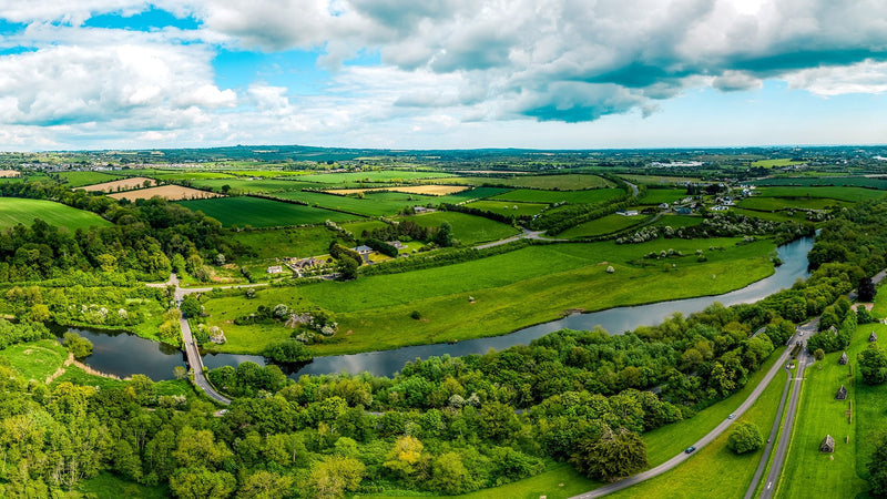
The first stop on your adventure in the Boyne Valley is the historic town of Trim- this fantastic town trail breathes life into the historical significance of Trim.

Start at the Visitor Centre and follow the historical signs to learn about Trim and its history. Weaving around the streets of the medieval town you will see the old town gates, the remains of the old leper hospital, the Tomb of the Jealous Man and Woman. One of the more curious stops along the way will be Echo Gate where you can enjoy the crystal clear echo of whatever you shout.
Download Trim Historic Trail Map
Once you have completed the mornings walk head for Harvest Home Bakery for a delicious fresh lunch or get it to take out and enjoy in Trim Castle grounds along the banks of the river Boyne.

After lunch enjoy the Trim Castle River Walk. This tranquil river walk commences at Trim Castle and finishes at the ruins of the 13th century town of Newtown, providing a glimpse of life in Trim in the Middle Ages. From the interpretative panels, learn more about the medieval town; life in the porchfields; medieval past-times; farming and forestry. Once you reach Newtown, retrace your steps back to the Castle.
The Trim Castle River Walk takes approximately 30 minutes along well marked pathways.
The Castle Arch Hotel in the heart of Trim is the perfect base to relax and enjoy dinner and a good nights sleep after your day exploring Trim.

Kells
Day 2 will take you to the heritage town of Kells where you will be spoiled for choice with the various walks and trails.
Kells Walk About- Discover all the history and heritage of Kells on this guided tour offered complimentary from volunteers, please contact kellscourthouse@discoverboynevalley.ie to arrange a tour or pop into the Tourist Office and pick up a map and take in the various historical sites throughout the town.

For lunch head for the Headfort Arms Hotel for a relaxed lunch before heading out again towards Girley Bog which is just a few minutes outside of Kells.
Kells Girley Bog Eco Walk is a 3.5 miles/ 5.6 km waymarked National Loop. It covers a varying landscape of forest and bogland. The terrain is flat and uneven and walking boots are recommended. The first section of this looped walk takes you through a tranquil Coillte forest, where there is a coniferous forestry plantation located on high bog.

After this section, you will follow a forest track before entering Girley Bog, one of the few remaining raised bogs in County Meath. Girley Bog is a site of considerable conservation significance, as it comprises of a raised bog, a rare habitat in the E.U. and one that is becoming increasingly scarce and under threat in Ireland. There is a wonderful variety of birdlife, plant and animal life and this is displayed through a number of interpretive panels along the walk. Listen out for the birdsong as you walk. The loop finishes with a walk along further country lanes before tracing your steps back to the carpark.
If you happen to be visiting Kells on a Saturday you will be able to visit Killua Castle for a walk around their extensive parkland and watch out for their herd of parkland deer.

Once you have completed your afternoon activities the Headfort Arms Hotel is a great base for the night where you are guaranteed a great nights sleep in one of their 45 luxurious bedrooms. For dinner you could head for the Vanilla Pod restaurant or The Bective both of which offer lots of local fresh produce across their menu.
Slane
Day 3 will lead you to the pretty village of Slane on the banks of the river Boyne and the Slane Historic Trail will lead you through one of Ireland’s most well-known towns, Slane has been shaped by centuries of continuity, personal commitment and constant reinvention. Legend says that over 1500 years ago, St Patrick lit a fire that signalled a transformation in Ireland’s identity.

For over three hundred years, one family – the Conynghams – have added new chapters to the town’s fascinating story as each generation made its mark. And for the past three decades, tens of thousands gather regularly at Slane Castle to enjoy the world’s most famous bands and musicians. During all this, the town has retained its unique charm, beauty and timelessness.
In a place whose story stretches back so far, there’s no need to rush. Instead, take your time and immerse yourself in the tales of saints, kings and stars that make this special place so fascinating.
Details of map collection: Download Slane Historic Trail Map
You could also do the Ramparts Walk which is accessible from Slane Bridge and follows the towpath of the Boyne Navigation along the banks of the Ramparts walk Slane River Boynebeautiful River Boyne. This is a favourite route of local walking group, Slane Striders and is also popular with visitors to Slane. Note: One kilometer past Slane Castle the pathway enters private land and terrain can be difficult at times. The walk continues from Stackallen, just 10 minutes outside Slane village, and goes along the river as far as Navan. Look out for information on the area and wildlife along the way.
For lunch walk down to Slane Castle which is on the outskirts of the village and enjoy a delicious lunch in Browne’s Bar or head for The Conyngham Arms Hotel int he village centre before you head up the road towards Drogheda.
In the afternoon you can enjoy the scenic Boyne Greenway, running from Dominic's Park on the south bank of the River Boyne near the Bridge of Peace in Drogheda, the Boyne Greenway takes you along the river close to the Mary McAleese Cable Bridge and then along the Boyne Canal to the Battle of the Boyne Visitor Centre at Oldbridge.

The walking and cycling facility utilises sections of boardwalk to create a riverside resource connecting Drogheda’s town centre to the Oldbridge Estate, via the existing ramparts. Along the boardwalk are a number of heritage signs with information about Irish Mythology relevant to the Boyne Valley. There are also a number of self guiding walks to be enjoyed through parkland at the Battle of the Boyne site, Oldbridge Estate. Find out more about this trail HERE
Scholars Townhouse Hotel is an atmospheric boutique hotel in the centre of Drogheda and is the perfect base for the night. Enjoy a delicious dinner in their multi award winning restaurant followed by a stroll around the town.
Boyne Valley Camino
Day 4 begins and ends with the Boyne Valley Camino! The Boyne Valley Camino is a self-guided, 25km looped walk from Drogheda, which forms part of the Celtic Camino series. It was created by the Boyne Valley Walking and Drogheda Walks teams. The walk goes along the Boyne, through beautiful Townley Hall woods, via two OPW sites of Mellifont Abbey and Oldbridge House, through the village of Tullyallen, along the Boyne Canal, and returns to Drogheda along the stunning Boyneside Trail.

Official Camino Passports can be used to collect beautiful stamps created by local artists en route. This 25km Boyne Valley Camino can be continued in Galicia by walking the old pilgrim route from A Coruña (the port of landing of pilgrims from Ireland through ages) to Santiago de Compostela (75km) to complete the 100km required to receive an official Compostela.

Download a Boyne Valley Camino Map & Guide or pick up a copy from the Drogheda Tourist Office at The Tholsel, West St, Drogheda
Dundalk and Carlingford
Day 5 and possibly your last day depending on how many walks you want to take in throughout the Dundalk and Carlingford region of which there are many to choose from!
Dundalk Slí na Sláinte 7.4km route walk starts at Dundalk Shopping Centre and follows the Dublin Road past the Louth County Hospital on your right and the Regional College to the junction with the N1 By-Pass. You turn here and follow the road past Heinz, Fás and National Tile until you come to the Barrack Street Junction (just before John Short Hire). Turning left you go along Seatown Place past St. Vincent's Secondary School. Coming to St. Patrick's Cathedral you follow the one way traffic system up Francis Street, past the Imperial Hotel and along Park Street and Dublin Street back to Dundalk Shopping Centre. After this walk a great place to enjoy a rest and some delicious lunch is The Spotted Dog restaurant.
You could then explore Dundalk some more or head up the road towards Carlingford where there are many different walks and trails to enjoy around the lough and in the mountains including the Slieve Foye Loop. This National loop walk brings you up to the mountains slopes above Carlingford. The walk is mostly on good paths marked with blue arrows.
Map yohttps://www.visitlouth.ie/explore-and-do/do/tours-and-trails-louth/cooley-and-slieve-foye-walks-and-hikes.html
Carlingford Lough Greenway
https://www.visitlouth.ie/assets/uploads/documents/15.06.11.GreenwayMap.pdf
Carlingford Lough may or may not be a true fjord but everyone, both before and since the Vikings who named it, recognises its scenic beauty and peace. Louth County Council, working in partnership with local farmers, and with funding from the government’s Transport 21 programme, has built a new footpath and cycleway, the Carlingford Lough Greenway, along the lough’s southern shore. Built mostly along the old railway line, the Greenway connects Omeath and Carlingford and as an old railway line it’s also very level.
It’s a great place for a bit of a walk and ideal for novice cyclists, including the wee ones. The Greenway provides great views across the lough to the mountains of Mourne, while Slieve Foy towers over it on the Louth side. The Greenway runs through fields full of grazing sheep, over old level crossings and even a few bridges. There are trees, wildflowers and birds to be seen along most of the way too.
It’s a great day out, with a variety of restaurants and cafes, in both Omeath and Carlingford, in which you can reward yourself after
We hope this itinerary has given you some inspiration for your visit to the beautiful Boyne Valley. For more information visit DiscoverBoyneValley.ie